
Sliema
Sliema beaches
Sliema has no sandy beach. You swim off the flat limestone rocks along Tower Road and at Qui-Si-Sana, where there are 4 official bathing sites, all with excellent water quality. For sand, St George's Bay is half an hour's walk away, and the big sandy beaches in the north are a direct bus ride.
Swimming in Sliema at a glance
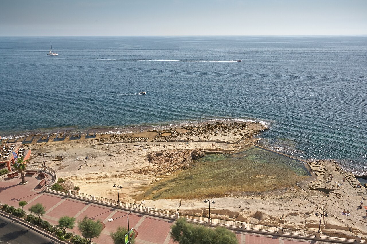
| Beach type | Rocky shore, no sand |
|---|---|
| Official bathing sites | 4: Qui-Si-Sana, By the Sliema Pitch, Fond Għadir, Exiles |
| Closures now | None in force at the last check |
| Bathing season | May to October, when the water is sampled |
| Nearest sandy beach | St George's Bay, St Julian's, about 2.4 km from Exiles |
Bathing sites
Where to swim in Sliema
The four stretches of shore that the Environmental Health Directorate samples as official bathing sites, from Tigné towards St Julian's. All of them face the open sea.
-
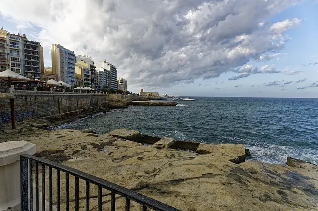
Photo: Txllxt TxllxT (CC BY-SA 4.0) · licence -
Tower Road · sampling point B13
By the Sliema Pitch
A stretch of rocky shore on Tower Road, sampled as its own bathing site. Bathing water monitoring point B13.
No closure in force · Water quality: Excellent (2025 EU rating)
-
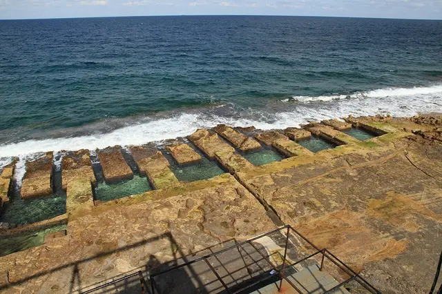
Photo: Frank Vincentz (CC BY-SA 3.0) · licence Tower Road · sampling point B12
Fond Għadir
A rocky stretch of Tower Road with square pools cut into the limestone. They are often called the "Roman baths", but were most likely dug in the 19th century, when Malta was a British colony. Bathing water monitoring point B12.
No closure in force · Water quality: Excellent (2025 EU rating)
Bus stop: Ghadir
In summer, paid lidos and beach clubs with sun loungers, umbrellas, pools and bars open along the Qui-Si-Sana and Tigné seafront. Most of the rocky shore between them is free: bring a towel or mat, as the rock is hard and gets hot.
The whole stretch is part of the seafront walk. See the Sliema promenade for the route, toilets and buses.
Water quality and closures
Every Sliema bathing site was rated excellent, the top EU grade, for the 2025 season. The rating is based on samples taken through the bathing season. A site can still be closed for a few days after a sewage overflow or other pollution, when the health authorities put up "bathing prohibited" notices until tests are clear again.
Recent closures
- Qui-Si-Sana: bathing prohibited, 4 July 2026 to 11 July 2026
- Fond Għadir: health advisory, 20 June 2023 to 22 June 2023
- Fond Għadir: bathing prohibited, 15 June 2023 to 24 June 2023
- Qui-Si-Sana: bathing prohibited, 1 July 2022 to 16 September 2022
- Fond Għadir: bathing prohibited, 22 June 2022 to 30 June 2022
Ratings: European Environment Agency bathing water data. Closures: Environmental Health Directorate notices and news reports, checked 29 September 2026. Always follow the notice boards at the shore.
Swimming off the rocks
- Check the sea first. The Sliema shore faces north-east, so winds from the north or east push waves onto the rocks, while southerly and westerly winds leave it calm. Today's sea conditions tell you which it is.
- Use the ladders and steps where there are some, and look at where you will get out before you get in. Getting out is harder than getting in when there is a swell.
- Wear water shoes. The rock is sharp in places and slippery near the water, and sea urchins live on the rocks below the surface.
- Mind the heat. There is little shade on the rocks. In July and August, swim early or late in the day and take water with you.
- In an emergency, call 112.
Sandy beaches near Sliema
| Beach | Where | Getting there from Sliema |
|---|---|---|
| St George's Bay | St Julian's (Paceville) | About 2.4 km, half an hour on foot from Exiles, past Balluta and Spinola Bay |
| Golden Bay and Għajn Tuffieħa | North-west coast | Bus 225 from Sliema to Għajn Tuffieħa, about once an hour; Golden Bay is the next bay along |
| Mellieħa Bay (Għadira) | North, near Mellieħa | Bus 222 from Sliema towards Ċirkewwa, stop Għadira |
| Blue Lagoon, Comino | Comino | Boat trips from the Strand; there is no public ferry from Sliema. See Comino trips. |
Bus routes and stops: Malta Public Transport, checked 7 October 2026. Walking distance measured with the OpenStreetMap walking router. Check times on the tallinja app before you travel.
More in Sliema
- Sliema weather: the five-day forecast and sea temperature by month.
- Sliema promenade: the seafront walk from the Ferries to Balluta.
- Things to do in Sliema: forts, churches, gardens and what's on.