
Sliema
Sliema promenade
Sliema's seafront runs for about 4.3 km, from the ferry landing on the Strand, round Tigné Point and along Tower Road to Balluta Bay on the edge of St Julian's. It is flat, free and open at all hours: a walk, a jog or a place to swim off the rocks.
The promenade at a glance
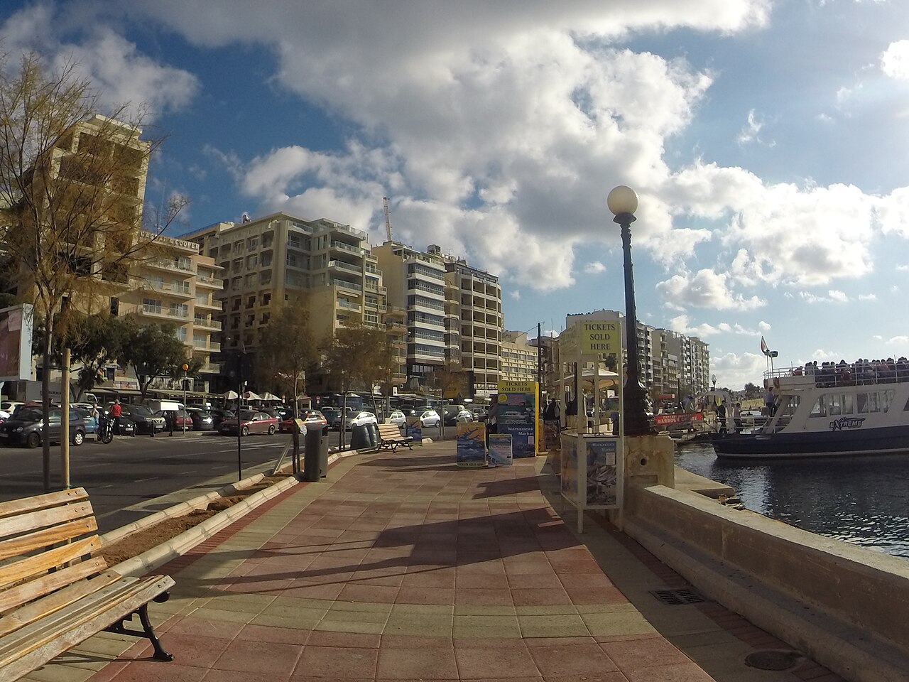
| Length | About 4.3 km, Sliema Ferries to Balluta Bay |
|---|---|
| Walking time | About an hour at an easy pace, without stops |
| Two seafronts | The Strand (Ix-Xatt) faces Marsamxett Harbour and Valletta; Tower Road (Triq it-Torri) faces the open sea |
| Surface | Flat paved promenade, lit at night |
| Cost | Free, open at all hours |
Ferries to Balluta
The walk, stop by stop
In walking order, with the distance from Sliema Ferries. You can start anywhere: buses stop all along the seafront, so it is easy to walk one way and ride back.
-
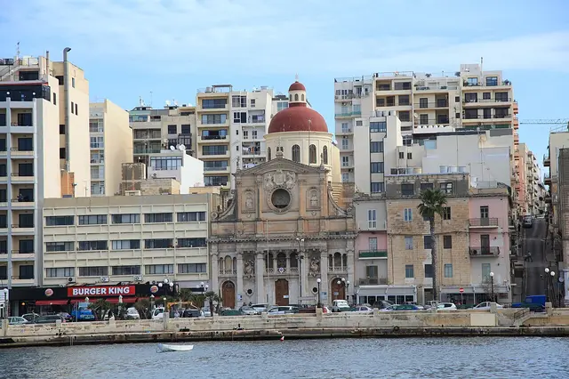
Photo: Frank Vincentz (CC BY-SA 3.0) · licence Start · Harbour
The Strand and Sliema Ferries
Ix-Xatt faces Marsamxett Harbour and Valletta's bastions across the water. The Valletta ferry leaves from the landing here, and harbour cruises and boat trips to Comino depart from the same stretch.
Bus stops: Ferries 1, Ferries 2, Ferries 3, Ferries 4, Ferries 5
-
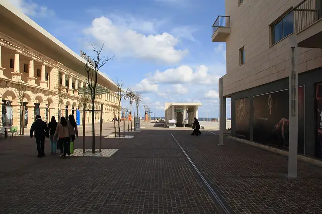
Photo: Frank Vincentz (CC BY-SA 3.0) · licence 0.85 km · Shopping
Tigné Point and The Point
The former British barracks and fortifications on the Tigné peninsula were redeveloped in the early 21st century into apartments, the Pjazza Tigné square and The Point shopping mall, with views across the harbour to Valletta and Manoel Island.
-
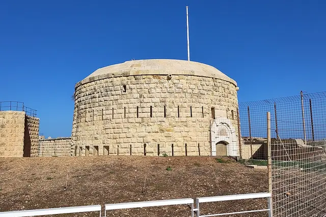
Photo: Josi (CC BY-SA 4.0) · licence 1.2 km · short detour · History
Fort Tigné
Built by the Order of St John between 1793 and 1795 at the tip of Tigné Point, it is one of the oldest polygonal forts in the world. It was restored in the early 2000s; it is not open to the public, but its circular keep can be seen from the Tigné seafront.
-
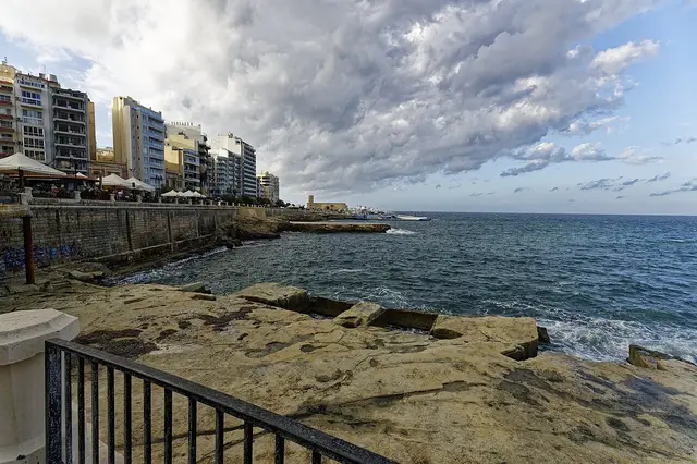
Photo: Txllxt TxllxT (CC BY-SA 4.0) · licence 1.3 km · Swim
Qui-Si-Sana
The flat rocky shore at the Tigné end of the seafront, with a wide promenade and seasonal lidos. Bathing water monitoring points B14 and B15.
Water quality: Excellent (2025 EU rating)
-
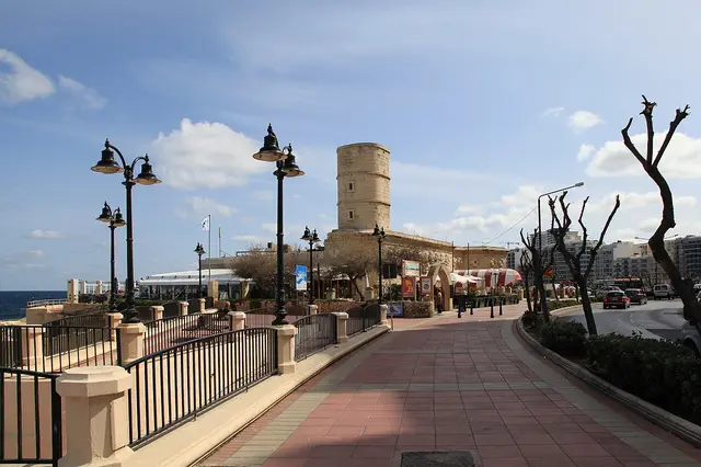
Photo: Frank Vincentz (CC BY-SA 3.0) · licence 2.05 km · History
Il-Fortizza (Sliema Point Battery)
A British artillery battery built between 1872 and 1876 on the point between Marsamxett Harbour and St Julian's Bay. It is now a bar and restaurant on the Tower Road seafront.
-
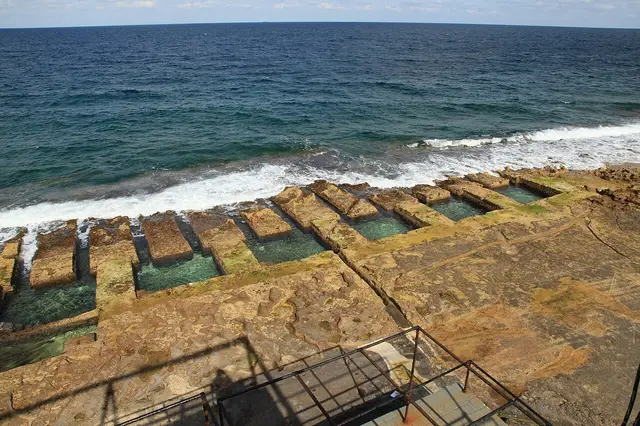
Photo: Frank Vincentz (CC BY-SA 3.0) · licence 2.5 km · Swim
Fond Għadir
A rocky stretch of Tower Road with square pools cut into the limestone. They are often called the "Roman baths", but were most likely dug in the 19th century, when Malta was a British colony. Bathing water monitoring point B12.
Water quality: Excellent (2025 EU rating)
Bus stop: Ghadir
Map · Sea conditions today · Sliema beaches · Source: MaltaToday
-
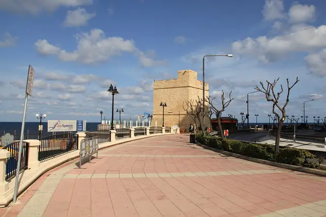
Photo: Frank Vincentz (CC BY-SA 3.0) · licence 3.3 km · History
St Julian's Tower
Despite its name, this coastal watchtower is in Sliema, on Tower Road. It was built in 1658 by the Order of St John, with an artillery battery added around it in 1715. The tower now houses a restaurant.
-
3.4 km · Swim
Exiles
A small bay at the St Julian's end of Tower Road, with ladders into the sea and a popular swimming spot. Bathing water monitoring points B10 and B11.
Water quality: Excellent (2025 EU rating)
Bus stop: Exiles
-
3.6 km · Park
Independence Garden
Ġnien l-Indipendenza is a coastal garden laid out in 1990 on abandoned farmland by the sea.
-
4.25 km · End of the walk
Balluta Bay
The promenade ends at Balluta Bay, where Sliema gives way to St Julian's. Keep going along the coast road to reach Spinola Bay.
Distances are walking distances from Sliema Ferries, measured with the OpenStreetMap walking router on 7 October 2026.
Swimming along the promenade
Sliema has no sandy beach. You swim off the flat rocks and from ladders along Tower Road, at Qui-Si-Sana, Fond Għadir, by the Sliema pitch and at Exiles. All of these are official bathing sites, sampled for water quality through the bathing season, from May to October. They face the open sea, so check the waves before you go in.
- Exiles: no closure in force; water quality excellent (2025 EU rating).
- Fond Għadir: no closure in force; water quality excellent (2025 EU rating).
- By the Sliema Pitch: no closure in force; water quality excellent (2025 EU rating).
- Qui-Si-Sana: no closure in force; water quality excellent (2025 EU rating).
Sliema beaches and the nearest sand · Today's sea conditions and swimming advice · Sea temperature by month
Toilets, buses and parking
- Toilets and drinking water: there are public toilets at points along the seafront, including at Tigné, Qui-Si-Sana and near St Julian's Tower. The Sliema practical guide maps them, with drinking water points.
- Buses: Tower Road has stops at Exiles, Ghadir, Torri, served by 16 routes including the TD3 airport express. On the Strand, buses stop at Ferries 1 to 5. See Sliema buses for where each route goes.
- Ferry: start or finish at Sliema Ferries and cross to Valletta. See ferry times and fares.
- Parking: seafront parking is limited, especially in summer and at weekends, so the bus or ferry is usually easier.
- Heat: in summer, walk early in the morning or in the evening, and carry water.
In rough weather
Tower Road faces the open sea to the north-east. When strong winds blow from the north or east, waves can break right over the promenade and soak anyone walking along it. On those days, keep back from the edge and stay out of the water. The Strand side, inside the harbour, is more sheltered.
Check today's weather, waves and any Met Office warnings before you set out.
More in Sliema
- Things to do in Sliema: forts, churches, gardens and what's on.
- What's on: events, feasts and fixtures this week.
- Getting to Sliema: from the airport, Valletta and Gozo.